Business Details
Expert Aerial Photography Services in Texas
Red Wing Aerial Photography has been a trusted provider of aerial imaging solutions for over two decades, serving commercial real estate, construction, and energy sectors across Texas. Our team combines technical expertise with artistic vision to deliver high-quality imagery from diverse platforms including drones, helicopters, and airplanes. With bases in San Antonio, Dallas, and Houston, we offer daily flights within a 200-mile radius, ensuring comprehensive coverage of Texas properties. Our services span ground-level architectural photography to high-altitude mapping, tailored to meet marketing, documentation, and assessment needs.Recognized for excellence by the Professional Aerial Photographers Association, we maintain rigorous standards in FAA-certified operations and client-focused service. Our vertically integrated approach eliminates the need for multiple vendors, providing seamless coordination of ground, drone, and traditional aerial photography. With a proven track record in complex projectsfrom construction progress monitoring to post-disaster assessmentswe deliver actionable visual intelligence that meets exacting professional requirements.
Services
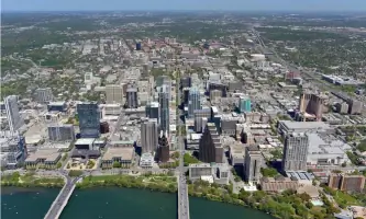
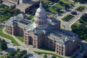
Aerial Photography
Drone Photography
Construction Progress Photography
Architectural Photography
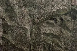
Vertical Mapping
Stock Aerial Images
Helicopter Photography
Airplane Photography
Videography
Site Reconnaissance
Highlights and features
- Award-winning aerial photography recognized by the Professional Aerial Photographers Association
- Comprehensive services covering ground, drone, helicopter, and airplane photography platforms
- Over 20 years of specialized experience in commercial real estate and construction imaging
- Available in major Texas metropolitan areas with 200-mile service radius
- Vertically integrated operations eliminating need for multiple photography vendors
Associations and certifications
- FAA Part 107
What people say
Photos look great
Flexibility and attention to detail
Timely, high quality work
Fantastic job
Prompt and courteous delivery
Services
Aerial Photography
Professional aerial photography capturing properties and landscapes from airplanes and helicopters. Our high-resolution images showcase location advantages, site layouts, and architectural features from altitudes between 1,000 and 3,500 feet. Ideal for marketing materials, site analysis, and geographic documentation across Texas.
Drone Photography
Low-altitude drone photography providing dynamic perspectives for property marketing and documentation. FAA-certified operators capture detailed exterior features using DJI Phantom, Mavic, and Autel Evo drones. Perfect for showcasing architectural aesthetics, site amenities, and immediate surroundings with precision and creative composition.
Construction Progress Photography
Comprehensive photographic documentation of construction projects from groundbreaking to completion. Services include scheduled progress shots, large-format prints, and digital deliverables for stakeholder reporting. Our systematic approach ensures consistent visual records that track development timelines and quality control measures across commercial and industrial sites.
Architectural Photography
Professional ground-based photography highlighting architectural features for real estate marketing. Services cover commercial properties including multifamily units, office spaces, and retail centers. Our photographers capture interior and exterior elements that emphasize property value, with optional elevated perspectives showing parking capacity and customer activity.
Stock Aerial Images
Access to 142,000+ pre-existing aerial images covering Texas and surrounding regions. Cost-effective solution for immediate needs where custom flights aren't required. Images available at significant discounts when purchasing complete location galleries, with resolution suitable for digital and print applications including marketing collateral and presentations.
People
Kevin Butts
President
Award-winning aerial photographer with over 20 years of experience specializing in commercial real estate and construction documentation. Recipient of Professional Aerial Photographers Association's Judges Choice award for construction progress imagery. Leads FAA-certified operations ensuring technical excellence and regulatory compliance.
Questions
What industries benefit most from your services?
We primarily serve commercial real estate, construction, and energy sectors with specialized imaging for property marketing, project documentation, and infrastructure assessment.
How do I determine the best photography platform?
Platform selection depends on project requirements. Drones excel at low-altitude detail, helicopters offer mid-altitude flexibility, and airplanes provide high-altitude contextual imaging. Our team advises on optimal solutions.
What's included in standard aerial packages?
Packages include multiple compass-point shots at specified altitudes, delivered electronically. Optional add-ons include print materials, enhanced resolution files, and custom graphic presentations.
How soon can you schedule a shoot?
We recommend booking two weeks in advance for optimal weather conditions, though we accommodate urgent requests when possible with our Texas-based aircraft and personnel.
What image formats do you provide?
Standard deliveries include web-ready digital files. Commercial print quality 36-megapixel TIFFs and physical media like CDs are available upon request for professional publishing needs.
Can you photograph restricted sites?
Our FAA-certified drone operations follow all airspace regulations. For restricted areas, we utilize permitted helicopter and airplane platforms to ensure legal and safe image capture.
Videos