Business Details
7 Years
experience
Professional Real Estate Photography Services in Happy Valley, OR
With over two decades of experience in photography and video production, I bring extensive compositional, lighting, and post-processing expertise to real estate photography, providing clients with professional, well-crafted images that sell homes faster. My journey began at age 12 when my father taught me to process and print black-and-white film in our home darkroom. By 18, I curated a gallery showing of concert photos at the Pacific Grove Art Center and was published in BAM Magazine, establishing my foundation in visual storytelling. For many years, I immersed myself in the local music scene, shooting promotional stills and live performances for Monterey Bay Area entertainment magazines while earning a BA in Radio & Television from San Francisco State University. After graduation, I worked as a radio DJ, TV news studio technician, and Director of Photography for corporate clients, expanding my skills in live music, comedy, and entertainment production.In 2019, I published a coffee-table book celebrating the 40th anniversary of the closing night at Winterland, combining my passion for historical documentation and photography. Today, I specialize in real estate photography, leveraging advanced technologies like iGUIDE virtual tours and LiDAR scanning to deliver precise, market-ready visuals. My services include architectural and design photography, drone imaging, twilight photography, and 3D virtual tours tailored to real estate professionals. I am committed to streamlining project planning through accurate as-built CAD drawings and square footage analysis that adheres to AIA standards and ANSI certification. My work serves builders, architects, and real estate agents across the Portland Metro Area, including Clackamas and Multnomah Counties, helping them visualize spaces and expedite sales processes.
Services
Real Estate Photography
Virtual Tours
Drone Services
Video Production
Twilight Photography
CAD Floor Plans
Measurement & CAD
Details
- Year established: 2019
Highlights and features
- 20+ years of professional photography and video production experience
- Uses ANSI-certified measurement technology for precise floor plans
- Offers integrated 3D virtual tours and CAD documentation
- Specializes in real estate visualization with twilight photography
- Provides real-time collaboration tools for remote project management
Associations and certifications
- ANSI
- AIA
Services
Real Estate Photography
Professional real estate photography captures properties in optimal light to accelerate sales. Services include high-resolution stills, twilight photography, and HDR imaging. Our expertise ensures accurate color representation and composition that highlights key property features.
Virtual Tours
Interactive iGUIDE virtual tours allow online exploration of properties with measurement capabilities. Users can navigate floor plans, measure rooms, and view properties in 3D space. This technology enhances buyer engagement and reduces physical showings.
CAD Floor Plans
ANSI-certified CAD floor plans provide 1/4-inch accurate measurements for real estate transactions and remodeling. Deliverables include DWG files, reflected ceiling plans, and dimensional drawings that meet AIA standards for professional use.
Drone Services
Licensed drone photography captures property exteriors, lot dimensions, and neighborhood context. High-resolution aerial images enhance marketing materials and provide comprehensive property documentation for real estate listings.
Measurement & CAD
Precise space measurements using LiDAR technology enable accurate square footage calculations and renovation planning. Services include real-time collaboration tools for architects and builders to review dimensions and project details remotely.
People
Sfvisuals
Owner
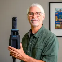
Professional photographer with 20+ years experience in real estate, architectural, and music photography. BA in Radio & Television from SFSU, published author, and ANSI-certified measurement specialist serving Portland Metro area real estate professionals.
Questions
What real estate photography services do you offer?
We offer architectural photography, virtual tours, drone imaging, twilight photography, and precise CAD floor plans using iGUIDE technology.
Do you serve areas outside Portland?
Our primary service area includes Clackamas and Multnomah Counties in the Portland Metro Area.
How do your virtual tours benefit real estate listings?
Our 3D virtual tours provide interactive property exploration, helping buyers visualize spaces and accelerating the sales process.
Can you create CAD drawings for remodeling projects?
Yes, we provide ANSI-certified CAD floor plans with 1/4-inch accuracy for remodeling, permitting, and construction projects.
What makes your real estate photography unique?
Combining decades of artistic experience with advanced LiDAR scanning ensures visually compelling, technically precise property documentation.